

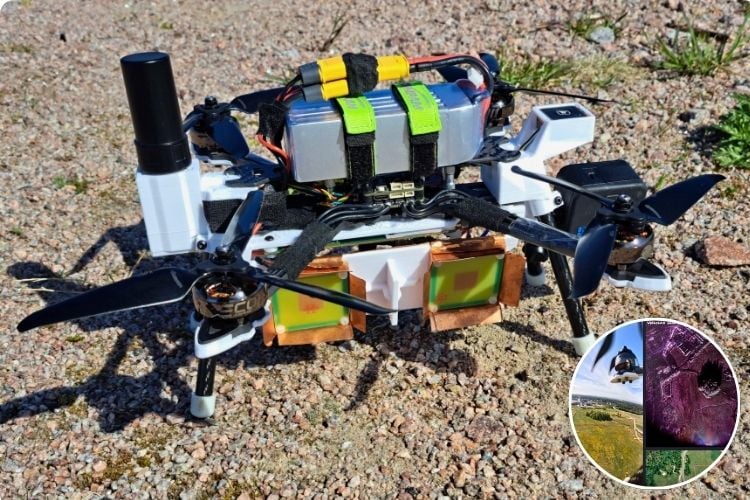
This DIY drone is doing something much more than taking aerial photos. It uses a custom FMCW radar to create detailed images of the ground from the air.This is built by Henrik Forstén.The system sends radio signals toward the ground and measures the signals that bounce back. As the drone flies, it collects thousands of these measurements and combines them using Synthetic Aperture Radar (SAR) to create a detailed radar image. The system has been tested over an area of about 1 × 1 km, showing how a small drone can be used for radar-based ground imaging.
The project gets even more interesting when the drone flies over the same area twice at slightly different heights. The system compares the radar signals from both flights to estimate differences in the height of the ground. This technique is called Interferometric SAR (InSAR). Since even a small position error can affect this measurement, the drone uses RTK GPS to track its position much more accurately, reaching around 1-2 cm accuracy under suitable conditions. The creator also developed software methods to correct small changes in the drone’s flight path so that the two radar measurements can be compared more accurately.
There is also a lot of data to handle during each flight. The radar produces around 75 MB of raw data every second, which is too much for the storage system to save directly. To solve this, the creator added a data compression system inside the radar’s FPGA, reducing the amount of data by about 2.5 times without losing information. The project was also tested against a LiDAR-based ground-height map, with the reported results showing a 0.4 m RMS height difference over the comparison area. With the radar and drone hardware costing around €1,000, this project demonstrates how custom radar, accurate positioning and clever software can turn a relatively small drone into a system for detailed ground imaging and height measurement.

Add a comment
No account needed. Your comment appears once a moderator has reviewed it.